Showing posts with label Cairntable. Show all posts

Sunday, 25 March 2018

Cairn Table - 21 March

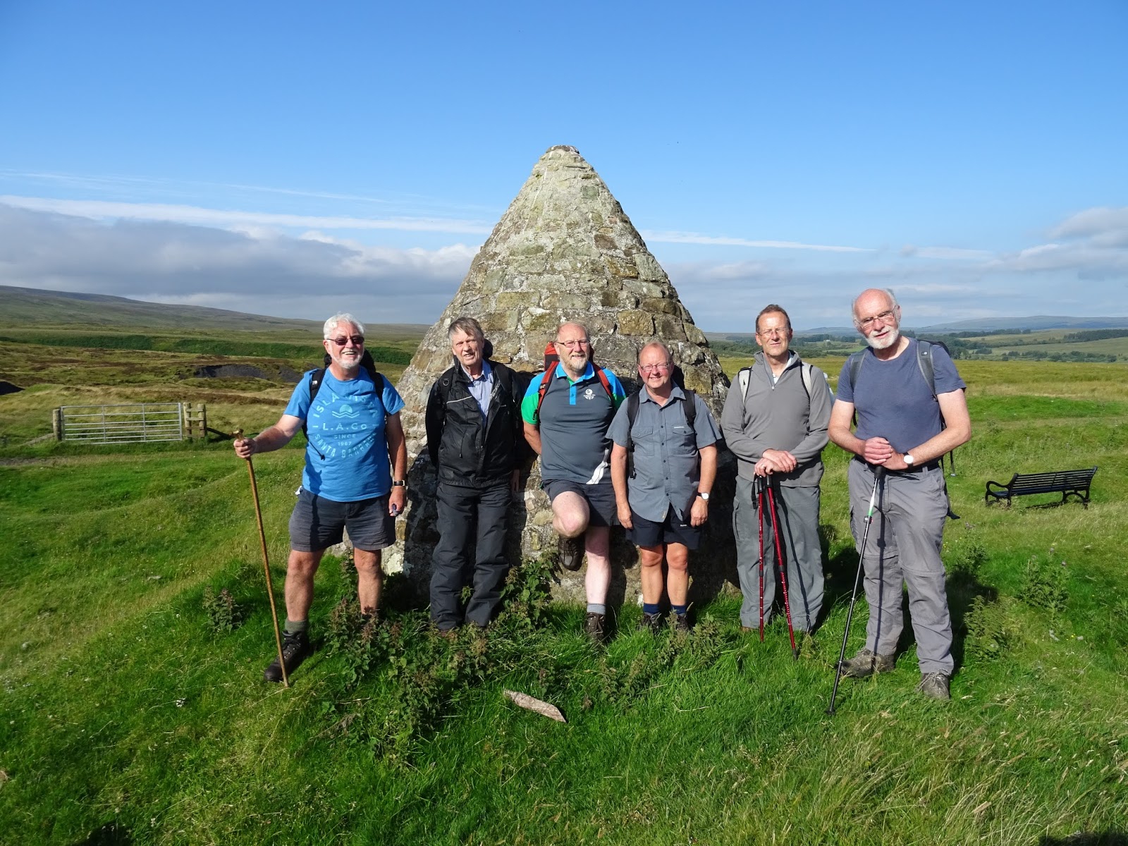
Ian, Malcolm, Paul, Rex, Dougie, Gus, Davie C, Alan, Kenny T, Davie M.

Eight people, one dog and three cars assembled at Glenbuck for the walk; with Rex and Dougie, delayed by traffic in Ayr,  phoning to say they would head straight to our official starting point at Kames.

Even our mathematicians were having problems with this logistical poser.  We were considering phoning Robert in France to see if he had a solution when the aforementioned duo turned up at Glenbuck. Now it was simple - 10 people and a dog squeezed into two cars with two cars left behind.

If the blog is to be believed, the Ooters last visit to Cairn Table was on 31 August 2016 and the record shows that on that occasion we all had the opportunity to admire Gus's plums.

So this was a new walk for some and a long overdue repeat for others.

The weather was dry, with a cool wind and the promise of rain later.  From the start the pace was fast and once we started the climb proper we were soon well spread out on the hill. Ian and Gus, the drillies, raced off into the distance with the rest of us pechin' behind them.

Fortunately, the previous Cairn Table blog had been written dictated by Davie M and  he recorded a time of 1 hour 30 minutes to the top. This time he announced "1 hour 20  minutes", which was a fine achievement for a septuagenarian, but still 10 minutes slower than the time the young bucks had  registered.

Attached to a post near the cairn, and fluttering in the wind in the style of a Tibetan prayer flag, was a brand new Rangers scarf. Whether it had been placed there to seek divine intervention, or whether it had been left there in disgust after the home gubbin' by Killie, we couldn't be sure but Malcolm took all the barbs with admirable restraint.  We were sorry that Jim wasn't with us today, but Kenny took some photos for him.

It was chilly on top so we were soon up and going again - or at least the last to arrive were.

Ten Ooters managed to find half a dozen different ways off the hill but we all gathered beyond the ramshackle footbridge over the Douglas Water (that's its name according to the map) where the shooters' track ends.

The rain we had been expecting had now arrived and full waterproofs were donned, though the rain was never particularly heavy.  We continued beyond our usual lunch spot, finding shelter  on low banking at the side of the track. Then we completed our descent to Parish Holm, where the verges of the track to the A70 were carpeted in snowdrops.

After skirting Glenbuck Loch we were back at our cars, completing the walk 10 minutes faster than in 2016. Again we all piled into the two cars, though Holly was a bit reluctant to sit on Alan's knee.

FRT was taken at the Empire Bar. We were sorry  not to be asked "Does your dog bite?" since the regular at the bar has been in hospital for several weeks. We wish him well.

Distance 9.5 miles.


Friday, 2 September 2016

Muirkirk to Glenbuck via Cairntable

With Alan, Davie C, Davie Mc, Ian, Kenny R, Kenny T,  Rex, Malcolm and Paul
(T Rex  - LOL! the typist)


Route - Kaimes car park, Muirkirk - Sanquhar Bridge - Cairntable - Parishholm - Glenbuck Loch

Weather - a cold wind ascending Cairntable and a 10 minute heavy shower going down the glen but glorious sunshine going round the loch.


first to the top

Time taken - one and a half hours to the top of Cairntable, 4 hours and 5 minutes in total.

How many Ooters to open a plastic bag? Nice plums, Gus, BTW


FRT taken in the Empire Bar as usual when in Muirkirk.


Report by Davie McM

Tuesday, 26 February 2013

20 February Muirkirk – Cairn Table – Glenbuck Loch - Muirkirk

Andy, Allan, Davie C, Davie Mc, Ian, Jimmy, Johnny, Paul, Peter, Rex & Robert

            Muirkirk in the eastern extremity of Ayrshire is a fascinating place; geologically, historically and archaeologically fascinating. Today we would explore some of these fascinating aspects of Muirkirk. (For an introduction to Muirkirk see Stuart Thomson’s webpage at www.freespace.virgin.net/stuart.thomson1/stpages/muirkirk)
            The town and parish of Muirkirk date back to the twelfth century when the monks of Melrose founded an outreach at Mauchline. They built a chapel of ease on the moors of that part of Ayrshire known as Kyle. This came to be known as the Muir Kirk of Kyle (Moor Church of Kyle) hence the name of the township that grew up round it. But we were not to explore this part of the parish today instead we would turn our attention to the southern part and to the top known as Cairn Table.

            Rex was late, mistaking the time of departure, but we waited patiently – well as patiently as we wait for anyone – at the walkers' car park at the ironworks institute at Kames for him coming before setting off along behind the institute to take the road signed for Sanquhar. The ironworks institute is all that remains now of the once thriving industrial centre that was eighteenth and nineteenth century Muirkirk, having been built as a recreation centre for the workers in the ironworks here. These Ironworks were established in the late eighteenth century and continued through the nineteenth and into the early twentieth. Nothing now remains of the works themselves only the institute and the place names - Ironworks Row and Furnace Road – to remind us.
The tarmac gave out after a few hundred metres but the old road continues as what was once a shooters road. This marks the old turnpike road that was built in the late eighteenth century as a short route from Glasgow to England and to take the produce of Muirkirk Ironworks to the centres where it was needed. Only the section of the turnpike north of Muirkirk is maintained as the public road to Stra’ven, the southern end having been abandoned early in the nineteenth century. It was along this southern section that we walked, waiting for Rex to catch up.
The reason we didn’t stop altogether and wait was the bitter east wind biting into exposed flesh and chilling even through layers of outdoor clothing. We wandered on slowly. We did stop eventually, in the lea of McAdam’s Cairn. This cairn marks the site of the British Tar Company’s works. The tar works was established here by the Earl of Dundonald to exploit the abundance of surface level coal around the town – coal that was suitable for tar extraction. The works were managed by, and eventually owned by, one John Loudoun McAdam who later made his name in England as a civil engineer and road builder. McAdam was a Trustee in the Cambuslang and Muirkirk Turnpike Trust that had the Sanquhar road built. He must have learnt his road building technique from James Finlayson, the engineer on the old road, a technique he was to refine in England and patent under the name macadamisation. There is nothing left of the Tarwork to remind us of its existence now only some bumps in the ground and this modern cairn.
Rex caught us up at McAdam’s cairn and we walked on. Evidence of early coal workings is dotted all over the moor here. The self-same monks who established the Muir Kirk of Kyle found coal easy to extract on this moor, the seams running close to the surface. The remains of medieval bell pits can be seen even from the old road as strange circular hollows in the ground where the old pit has collapsed and formed these weird-looking depressions. We noted some in the passing as we walked on round the Whisky Knowe – a conical mound by the side of the road in which, as legend supposes, casks of smuggled whisky are buried – and on to the Sanquhar Brig.
The old brig as no more, having been washed away on a flood of the late twentieth century but a modern footbridge takes its place and allows the pedestrian to continue the walk to Sanquhar. Our self-appointed guide for the day, Jimmy, pointed out the Minister’s Well on the other side of the burn, a green patch on the otherwise brown heather-slope and told us we could find other springs all around here, a result of some weird geology. We would be told more later.
We didn’t continue along the road to Sanquhar. We left the turnpike here and took to a path on the left-hand side to start our climb of Cairn table. Not so very far above the old road we crossed an artificial cut in the ground. This, explained our knowledgeable one, is the lade used to carry water to the tar works and the ironworks in the eighteenth century. And as our attention was drawn we could see the scar of it running across the hillside just above the track we had come along. But it wasn’t day to hang about and we set of again, upwards through the heather. Now we found the strength of the wind as well as its temperature. We kept moving.
We saw our first deer of the year as we walked above the cut and started on the hill proper. Allan hasn’t been feeling too well recently and this showed as he struggled upward. Eventually he had to call a halt and retreat. Johnny and Peter offered to keep him company and left us to climb on while they went for a lower level walk. We await a report.
The wind was chilling so the progress upward was constant. No time for hanging about getting cold. Davie Mc in his usual manner was well to the front and by the time we were half way up, he was nearly at the top. Still we plodded upwards in his wake. Near the top of Cairn Table the old red sandstone of the Devonian era outcrops. Trickling from this is another of Muirkirk’s springs. At around the 1900ft contour, it is higher than the surrounding hills. ‘An artesian spring’ announced our self-appointed guide ‘The water apparently has the same chemical constituents as Loch Katrine in the southern highlands.’ Whether it is the same water which by some freakish geology makes its way from there to here, he wasn’t convinced but this is the story that’s told about it. The spring does run at the same temperature summer and winter indicating a deep source but where the source is nobody is quite sure. Ian sampled the water and pronounced it tasting like - water! An excellent recommendation for your dram.
Another forty feet of climbing brought us to the frost-shattered boulders and native old red sandstone outcrops of the summit. The county boundary between Ayrshire and Lanarkshire crosses the summit with the highest point, a bronze-age burial cairn, being on the Lanarkshire side. Not to be outdone, the striking miners of 1926 erected a huge war memorial on the Ayrshire side. This is the cairn that can be seen from the town. Rising some twenty-odd feet above the natural level, it is now the highest point on the summit. To build it to such an excellent standard needed skilled men and equipment. These were brought to the summit in a lorry driven by a local man. How he managed this we can only guess but it was some feat of driving not one that we would relish.
On the summit we hunkered down in whatever shelter from the cold wind we could get and had a bite to eat.

After coffee we crossed into Lanarkshire, crossed the burial cairn and started our descent toward the young Douglas Water. It was on the descent that we encountered our first snow, hard as concrete and great to walk on. It wasn’t until Robert found the softer stuff and sunk up to his knees that we left the snow patches and took to a quad-bike track alongside the fence. Then, much to the irritation of some of our number Davie Mc took us along another set of tracks that he said was a better way. We all trust Davie Mc, don’t we? So we followed. And to everybody’s surprise these tracks brought us to the end of the shooters' road in the Douglas valley.
We kept to this for a while now, stopping only once for a lunch break at the bridge over the burn. As the road climbed away from the Douglas, we met a four by four pick-up bouncing down the rough track towards us. In it was a young man, a keeper on the Douglas Estate. He warned us to keep an eye out for Holly for he had just set some fox traps by the side of the road bated with choice leg of hare. We kept an eye on Holly for the duration. Good job as well for when she caught smell of the hare leg she was nearly in the trap after it. We caught her in time.
Then we crossed over from the valley of the Douglas to the valley of the infant River Ayr. The snowdrops were not quite into full flower on the high ground around Parishholm farm but there was enough there to suggest a superb show later in the spring. Then we crossed the road, climbed a fence and came to the shores of Glenbuck Loch.
Glenbuck Loch is totally man-made as can be noted from the dams at each end. It was created in the late eighteenth century to provide a constant head of water for the mills at Catrine amongst other things. Dams were constructed in the valley and the natural springs and runnels filled it up. It is now part of Glenbuck estate and is managed by Muirkirk Angling Club as a trout fishery. By its nature and situation it attracts wildlife and a hide has been built overlooking the fishery. It was in the hide that we chose to stop for another cuppa.
Glenbuck village no longer exists, the opencast mining of the area seeing to this, but a memorial to one of its greatest sons sits by the side of the road. This was of course Bill Shankly of football fame and something of a latter day saint to Liverpool supporters. It was at the instigation of the Liverpool Supporters Association with money from the opencast fund that this memorial was built. Some of our number can remember meeting with Liverpool supporters at the monument when we did this walk before. They had made a pilgrimage to Glenbuck just to see where Shankly was born and we can well remember the reverence with which they spoke about him.

 ‘Football is not a matter of life and death – it’s more important than that.’- Bill Shankly

We would now follow the River Ayr Way back to Muirkirk. Leaving Glenbuck, we came to the old railway – Ayr to Edinburgh – at the platform of Glenbuck Halt. Only some rotting sleepers holding back a bank that used to be the platform remind us that these ‘halts’ were once a common feature of country railways. But now even the railways that served these outlying communities have gone only to remain as level tracks across the open country. And the ‘halts’ are no more than grassy banks beside the track.
Not that we were in particularly ‘open’ country. No, for the first two or three miles we were in the valley of the infant Ayr, a burn that ran through the moss beside our track. There is not too much to be seen in the first two or three miles of the Way, only old railway tracks coming from long forgotten mines and quarries. The blethers of fellow Ooters were the only thing that provided amusement on this section. Then we came to the Muirkirk Canal.
In the early nineteenth century a better, more efficient way of transporting the produce of Muirkirk’s works to the customer was sought. Taking a leaf from the midlands of England, the works owners decided that if a canal could be made to the harbour at Ayr, much more could be exported at a greatly reduced cost. So began Muirkirk’s canal. It was never finished. No sooner had they started to dig than the railways arrived and the scheme was abandoned. No more than half a mile or so remains of the Muirkirk’s canal, no more than a waterlogged ditch beside the railway track.
We continued to follow the railway track back through the site of the ironworks to Kames and the waiting cars. This must be the longest walk of the year so far – around twelve miles and a hill taken in as well. Not too bad for old blokes.

Muirkirk is a fascinating place and we had just explored half of it. We look forward to exploring the northern part of the parish some other day. 

FRT was taken in our usual Muirkirk howf, The Coachhouse where an enjoyable hour or so was spent.

Tuesday, 21 February 2012

Cairn Table - 15 February

A somewhat reduced-in-number seven Ooters (Ronnie, Rex, Ian, Paul, Robert, Johnnie and Malcolm) gathered in the parking area at Glenbuck Loch on a cool, breezy but dry morning. There we pondered the logistics of ferrying all Ooters to Kames whilst having transport remaining at the Loch for the return ... and all to be done with three cars. It was decided it couldn't be done without a driver doing an extra journey unless there was some sitting upon knees (some were more in favour of this than others, but they were in a minority).

Transportation complete, and undeterred by the absence of the two Ooters with local knowledge, we prepared for the walk at Kames whilst having a chat with a fellow walker about to set off on a 15 mile hike. He regaled us with tales of his previous solo wilderness walks and succeeded in making us all feel a little wimpish.

The ascent of Cairn Table called for the usual view stops. Despite Cairn Table being shrouded in mist as we drove to Glenbuck - the only hilltop in the clouds (does that sound familiar?) - it had cleared nicely for our ascent. We could see Ailsa Craig to the west whilst in the distance, eastwards, we could see hills which might have been the Pentlands ... or they might not have been. Jimmy wasn't there to tell us.

On the way up to the summit the top of a walking stick, made of deer antler, was spotted on the path. A few weeks ago Davie M had lost such an item in snow on Cairn Table and we reckoned it was one and the same. Having kicked it aside ...

...no we didn't. It was retained and will no doubt be blu-tacked to someone's forehead when next we meet up, just to see how long it takes Davie to notice.

A strongish north easterly was blowing at the top so we took shelter in the lee of the impressive summit cairn for coffee.

Despite the recent rains and memories of boggy descents, the way down was relatively dry. We picked up a quadbike track which made for decent underfoot conditions and were quickly down the hill and onto the vehicle track. Here, whilst examining a pile of wooden stakes, Ronnie announced that he no longer had his stick with him. Ronnie, Paul, Rex and Ian had lingered for so long at the stakes that the others were out of sight, but knowing the caring nature of Ooters they reckoned those ahead would soon be aware that their number had been reduced from 7 to 3 and would return to find out what had befallen their comrades.

The four stragglers retraced their footsteps in search of the stick. Ronnie thought he might have left it at what Rex described as the "fence without wires" - "posts" to the rest of us, but it was nowhere to be seen. Ronnie decided he would continue retracing his footsteps and would go back to the summit of Cairn Table and then on back to the starting point at Kames. The three bade Ronnie farewell and set off in search of the rest of the group.

The three in front had indeed noticed that some of the party were missing and so made the decision to .... stop to eat lunch. Mobile phone communication, which had been non-existent, was eventually restored and the two groups were finally in contact again. Of course, the leading group had finished their lunch by the time the starving stragglers arrived and were keen to continue their way, so we did, although a little further on we did all stop for a second lunch break.

Contact was made with Ronnie. He had found no trace of his stick on top of Cairn Table and was on his way back to Kames. However, it's and ill wind which blows nobody any good, and Ronnie was instructed to drive to Glenbuck to meet us at the end of the walk - logistical problem solved!

We enjoyed more fine views of sunlit hills, including Tinto, as we made our way down to Parish Holm farm and the A70. The verges of the track from the main road to the farm were resplendent in snowdrops. And then it was across the road and around the loch to our parking place ... and we only had to wait 5 minutes before Ronnie turned up!

Refreshments were taken at the Coach House in Muirkirk, where we received the usual warm welcome from our young hostess.

A good day's walk in pleasant conditions. Ronnie might disagree.

Monday, 29 November 2010

24 November Cairn Table Once More


Alan, Allan, Davie, Ian, Jimmy, Malcolm, Paul, Peter & Robert

The weather was as you would expect for late November; a plunge of cold air from the Arctic gave us a heavy overnight frost and a bright, sunny but cold morning. It was bitingly cold when nine of us gathered at Kames car park in Muirkirk for a walk over Cairn table.
It was stated from the outset that this would be a much more relaxed outing than the yomp through the rain of last week. Anyway today had much better weather and it was a day for taking it easy.
The pace was casual as we walked up the old Sanquhar road, well wrapped up against the numbing frost. Up past the golf course clubhouse we went, up past Midhouse farm, up past the ruins of Springhill, up to McAdam’s Cairn, all without a break in the rhythm, trying to warm the blood against the frosty air. The moor was looking grand in the low sun and Jimmy (he of the fickle memory) decided he must capture the scene with the camera. Well, he might have done so had he not suddenly remembered that he’d left his camera on the passenger seat of his car. Not only that but he had left his wallet beside it, both in full view for anybody to see – silly auld bugger. So back went the somewhat abashed Jimmy, back the best part of a kilometre to retrieve the camera and secrete the wallet. He went with our usual words of encouragement ringing in his ears - ‘Have ye got yer specs oan?’ ‘Are ye sure you came in a car?’ ‘Will ye mind the wie back?’ ...............
Anyway, as Jimmy retreated, we walked on. For some reason Alan offered to carry Jimmy’s rucksack. We thought it somewhat strange but Alan was unconcerned and walked on double-loaded. Then the mischief came on us again. In Jimmy’s absence and with his rucksack in our possession, a dastardly plot was hatched. We would remove his peece-box before he arrived and watch his reaction when we stopped for lunch. Such childish antics still amuse us. Half an hour after leaving, Jimmy rejoined us where we waited at the Sanquhar Brig.
We left the old road at the Sanquhar Brig, taking the iced-up pad alongside the Garpel, kicking the cranreuch from the grassy stalks and heather. This is by far the easiest and best access to Cairn Table. The path rises gently away from the burn before climbing more steeply on the heathery flank of the hill itself. And as we rose with the path and the sun rose higher in the morning sky, so did our body temperature. The slope is steep but not too steep; it is just steep enough to make the effort hot and sweaty. And the air was cool, cold enough to catch the breath in great clouds in front of us and chill the sweat on damp skin. Yet we climbed higher, and as we climbed we caught the first stirrings of a bitterly cold northerly which added to the discomfort. It was in this state of freezing warmth that we stopped at the cairn half-way up the slope for a breather, turning our backs to the northerly.
While the rest of us had coffee while waiting at the Sanquhar Brig, Jimmy hadn’t and was determined to have one now. We waited, anticipating the fun when he discovered his peece-box to be missing. Jimmy took out his flask, poured himself a cup, rummaged through his rucksack obviously looking for something but said not a word. He is wise to us all now. Eventually his peece box was returned to him and he graciously thanked Alan for carrying it up the hill for him. So much for fun in this group!
Now with Jimmy in full possession of his belongings we walked on. The slope eased but the breeze didn’t. It continued to freeze exposed skin on one side while the sun warmed the same on the other. Yet we climbed. Peter had heard of the spring near the top and was always asking if we were near it. He was told, like all youngsters are, ‘Not yet. We’ll tell you when’. Eventually we came to the spring. ‘Nobody knows for sure where the water comes from’, said he who knows these things, ‘but it runs at the same temperature summer and winter and it’s higher than any of the surrounding hills’. He took time to say that the mineral make-up is the same as the water in Loch Katrine but drew the line at saying for sure that the water came from there. His lesson on artesian springs took a few minutes but the wind was chilling so we didn’t hang about too long. It was sad to note before we left though that the stainless steel cup that provided the thirsty with a means of drinking the water was no longer there. Another sorry comment on society.
The spring is barely twenty metres from the large cairn that acts as a war memorial and marks the summit of the hill. It was here that we settled down in the lea of the cairn and the rocky outcrops beneath it for a break in the winter sun. The view west, south and east was good. ‘You can see Wanlockhead from here’, said one, repeating a longstanding joke in the Ooters, a joke that has long since run its course but which still causes some amusement in the ranks. He who knows these things pointed out the hills from Tinto to Merrick and Arran. He might have pointed out some of the northern hills as well but none of us was prepared to leave the shelter of the cairn and face the, now fresh and bitingly cold, northerly. So we contented ourselves with fifteen minutes or so of relaxed blethers, taking in what view we had. But the itchy feet lot can’t sit too long and after quarter of an hour were champing at the bit to be off again. So off again we went.
It surprised most of us how sheltered we were behind the cairn for when we set off along the hill again, we came into the full force of the Arctic blast. Hard to believe though it is, not a lot was said for the next few minutes as it was heads down into the wind and down over the doogals towards Wee Cairn Table. We had a choice now; Davie was for doing the whole round to Glenbuck but none of the rest of us was up for that. ‘We could just go to the top of the hill there and drop down from there’, said he hopefully. None of the rest was up for that either. At Jimmy’s suggestion and much to Davie’s chagrin, we dropped down the hill beside a wee burn, the beginnings of the Crossflat Burn. Despite Davie’s dire warnings of huge doogals, deep sheughs and slimy bogs, an easy enough descent was made using what sheep-pads we could find. Eventually the myriad of sheep-pads unified into a more distinct path dropping us gently down the slope. And as we dropped the wind eased and the temperature became more comfortable. On a bank of short-cropped green grass we settled down for lunch.

We might have taken the path over the moor to Auldhouseburn Farm after lunch but the day was still young and to do this would mean an early finish. Instead, at Jimmy’s suggestion, we followed the Crossflat Burn, finding the remnants of a path to ease the way. This brought us down to the old railway that forms this section of the River Ayr Way. The Muirkirk area is a fascinating one for the industrial archaeologist. The courses of old railways criss-crossed the valley, running to long abandoned mines and works; the remains of a viaduct were noted where one of these crossed the river; the short section of the Muirkirk to Ayr canal was pointed out, a canal that was started only to be abandoned when the railways arrived; all fascinating stuff for those of us not familiar with the area. And it was with examining and discussing these industrial remains that the next hour or so back to Kames was spent. We arrived back in the walker’s car park around two, just in time to take FRT in the Coachhouse (or, as the pedants pointed out on the sign on the wall, the Coachouse)

This was another very good local walk and most were glad we didn’t take Davie’s suggestion to do the round to Glenbuck, especially Jimmy who did a couple of kilometres more than the rest of us. We wonder if he’ll remember to turn up next week?

Tuesday, 11 May 2010

5 May Over Cairn Table to Glenbuck

Young Johnny reaches the age of maturity on the thirteenth of this month and in true Ooters style, we were to celebrate his coming of age – bus pass age that is. But, since holidays were in the offing, Johnny chose to celebrate early and this was his chosen day. Because of this, a short walk was the order of the day and Cairn Table at Muirkirk was the preferred destination.
It looked as though the weather gods were smiling on us today for the sun shone in a clear sky and there was a warmth to the air. But, when we gathered at Glenbuck Loch car park, thin wisps of cloud crept across the sky.
We left cars at Glenbuck and motored back to the walkers' car park at Kaimes in Muirkirk. That’s where we felt the first stirrings of a breeze, but it was a mild breeze and we walked on ignoring it.
The old Sanquhar road was taken, not because we always go this way but because this is the best approach to the hill. The road is level and firm and the walking was easy. The moor was alive with birdsong; a whaup burbled in the distance, pipits ‘pipped’ in the heather and skylark sang overhead, invisible to us. But the naturalist was hopeful of better and carried his binoculars just in case. Up past Springhill we went, where John Loudoun McAdam once lived, up past McAdam’s Cairn marking the spot where McAdam’s British Tar Company had their works, and past the Whisky Knowe where barrels of whisky are reputedly buried. A sandpiper piped its way up the Garpel as we approached the Sanquhar Brig but this was the last wildlife we were to see until Glenbuck.
At the Sanquhar Brig there was a split in the ranks. The leading group swung off the main way to follow the newish section to a ford in the burn. Jimmy, Peter and Ronnie went to examine the brig. ‘The Caul’ Watter Spoot’s just ower there’, said Jimmy rattling the words off machine-gun-like. ‘Whit?’ asked Ronnie with a note of incomprehension. ‘The Coeld Woter Spout’, said Jimmy in his best Home Counties accent. Ronnie was relieved; he thought it was some sado-masochistic thing. But then, what else could we expect from a psychologist.
Meanwhile, the rest, having discovered the absence of the three, waited on the footpath by the Tar works Lade. That’s when we saw the trio crawling round the river bank, clambering over the heather and sliding on the bare earth. They had attempted to follow the old footpath only to discover that it had been washed away and ended up clambering round a landslip. Robert’s comment was right - silly auld buggers.
Re-united now, we followed the path through the heather. Despite some grubby sections, the path was surprisingly dry and progress to the foot of the steeper rise was swift. The heathery flank of Cairn Table though steeper, isn’t unduly so but it did separate the men from the boys.
Somewhere up the slope a thin cloud crept in and the sun disappeared. So did the bonhomie of the group. Davie and Rex - who else? - set a fair old pace on the climb. They were followed by Jimmy and Alan and Robert and Ronnie and Paul. Peter, Johnny and Allan brought up the rear, watching the rest disappear into the distance. There came a shout from the tail-enders for a stop. But Davie – who else? – said ‘We’ll stop for coffee just up here’, and walked on, the rest following. Judging by the abuse hurled in the direction of the leaders we don’t think that this action was appreciated by the trailers but we walked on regardless. ‘Just up here’ proved to be three hundred yards further up the flank of the hill. At the cairn where we always stop, we stopped for coffee and to let the rest catch up. When they did, there was dissension from two. Peter and Johnny, with an air of ‘We’ll show you, you sods’, walked on past and on up the hill throwing various comments at the leaders. Allan on the other hand, just happy to have somewhere to relieve his burning legs and lungs, collapsed in a crumpled heap beside the rest.
Whether Allan took in the view from the coffee stop was difficult to say but the rest of us did. From the Glen Afton hills through the high Galloways to the pale blue lump that might have been Ben Lomond in the north, the panorama wasn’t as good as it might have been. A dusty atmosphere hid Arran though the Ayrshire coast was clear. And the Highland line was shown only as a pale blue smudge rising to the lump of The Ben. But various Ayrshire landmarks could be identified so the view occupied the attention during coffee.
It was a short coffee stop for we wanted to catch the dissenters. So upward we plodded, Davie and Rex setting the pace again and the rest strung out down the slope. A brief, very brief, stop was had at the spring near the summit to test the water and catch the breath. This spring is a conundrum. It is situated just off the summit of the hill, higher than any of the surrounding landscape and flows at a constant temperature summer and winter, an indication of the complex geology of the Muirkirk area. It is reputed to have the same chemical make-up as Loch Katrine in the Trossachs, but this is more than fifty miles away. But even if it doesn’t come from this source, how it gets as high is a mystery. No doubt somebody at sometime will resolve the mystery but to us, a mystery it remains.
From the spring it was a short fifty foot climb to the summit where we found the rebel two ensconce in the shelter of the cairn having their own coffee. We sat down to join them.
The view to the east and south was open to us then. Tinto looked good with the sun still lighting it. From here through the Culter Hills, the Moffat hills and the Lowthers to the high Galloways, the panorama was extensive even if a bit on the hazy side and points of identification indicated by those who know. A pale grey-blue patch on the southern horizon showed where Criffel stood above the Solway. ‘Can you see Wanlockhead from here?’ asked a mischievous Paul alluding to a previous dispute on the subject. We could. But Allan’s inquiry about the number of lochs was completely lost on Davie in his own quiet world by the side of the War Memorial.
We sat for quite a while on the summit. But tempus fugit; so must we. So, with bodies recovered and esprit-de-corps restored, we set off downward, into Lanarkshire.
We could see the road we were heading for, a forest type road some half mile away, running down the valley of the infant Douglas Water. But between us and it lay a rough trackless slope of doogals. According to the Porter-Johnstone categorisation of Doogals, these were hairy but they were only grade three and were on our down-slope so presented little problem. We strode down the slope to find the end of our road.
This road was to take us nearly to the end of the walk at Glenbuck Loch. But before that lunch had to be taken. Where the road crossed the infant Douglas, we sat for the peece. We sat on the end of the brig – no more than two concrete pipes with the road laid on top – and dangled our legs over the edge. Though the water is still small here, at this side of the brig was a deepish pool, a pool that we thought Holly would enjoy. To entice her into the water, some started to throw small stones. Whether by accident or design, these stones with their accompanying splashes crept closer and closer to us spraying the legs with water. Retaliation was the order of the day. Eventually, Alan, with Hiroshima style overkill, lifted a boulder and heaved it into the pool. The resultant explosion sent a mushroom of water in the direction of Rex and Jimmy, drenching them from the knees down – particularly Jimmy. Since this blog might be read by those of a sensitive disposition, it is best not to write exactly what Jimmy said to this. Suffice to say that he wasn’t best please and swears (appropriate word) vengeance. Beware Alan. But like Hiroshima, this brought an end to our particular war and, with our infantile antics over, we walked on.
The sun made reappearance as we left the brig and followed the road down the waterside.
After a bit, the road left the side of the Douglas and climbed high on its valley side. At one time there was a breeding programme for Red-legged Partridge here but the birds seem to have disappeared now. Not so their pens. We passed one and the stench of rotting flesh hit us. Dead sheep, possibly casualties of the severe winter, were laid out in it. The smell rather than the sight caused a quickening of the pace. Or perhaps this quickening was due to the road for we were now on the down-slope, heading for Parish Holm. Whatever the cause, we found ourselves at parish Holm in good time.
Now there was only a short mile of level walking along the loch side to our destination. An angler stood on a boat in the water too busy returning his catch to the water to notice us passing on the bank. Perhaps Holly splashing into the water might have drawn his attention but he never acknowledged our presence as we walked round to the bird hide.
The new-comers were impressed by the hide; not only by the quality of construction but the fact that it has remained un-vandalised for so long. We sat in the hide for a few minutes while Davie plunked oranges seeds at all and sundry. He was lucky, on a day such as this, that he didn’t find himself up to the neck in loch water. But he didn’t and we all arrived back at the cars dry, even Jimmy and Rex had dried by this time.

This is turning into a favourite walk of ours. And to finish of another good day we took FRT in the Coachhouse in Muirkirk.

Later that evening we met again – this time joined by Ian – in the Rupee Room in Ayr for Johnny’s birthday do. After the meal we went over to the Wellington for the pub quiz. Result: Them 32, Us 30. Fluky @@@@@@s.

Monday, 10 May 2010

Monday, 3 November 2008

29 October -Cairntable 1945 ft

Due to Jimmy and Paul having other commitments today and therefore being unable to go for a walk, Davie was duly assigned the task of being the scribe; since the pair of them will probably go over the text to check what I have went and wrote, I had better watch my grammar!
We met at 10 am in Furnace Road, Muirkirk outside the Black Bull Hotel where we were later to rendezvous for our post walk libation.
Muirkirk has a most fascinating and interesting industrial history and indeed it was in Furnace Road that the gasworks (the Muirkirk Coke and Gaslight Company) opened in 1859, Muirkirk being the first town in Britain to be lit by gas; ironically it was also the last place in the UK to be connected to the national gas network, in 1977.
We proceeded to the Kaimes car park where we picked up Peter who had initially been missed by Rex as he (Peter) was having a pee behind the wee shelter. This walk was supposed to be a repeat of the one on the 13th February 2008 when Jimmy was the first in 2008 to don shorts. Since the weather forecasters had promised us really foul weather coming in about noontime, it was decided to curtail the walk and simply climb Cairntable from the Sanquhar Road and return down the front. 
Since there was a spot of rain while we were at the car park, we all duly donned wet weather gear and set off. Beyond the ruins of Springhill House, the newcomers to he Early Ooters had a look at the cairn commemorating the road-maker John Loudoun McAdam, erected on the site of his tar kilns.  Incidentally, Tar McAdam never used or promoted the use of tar in the building of roads; his nickname merely derives from from his association with the tar works.
Furnace Road itself was built by McAdam as an early experiment in road construction; it was one of the first ever to use the engineer's revolutionary methods of compacting small broken stones, and slag from the ironworks further up Furnace Road, into to a mass that was impervious to moisture. 
(turning into a ********  history lesson this)
We shortly reached the Sanquhar Brig and left the old road, originally part of a coach road linking Glasgow with Carlisle and constructed in 1793. No doubt Jimmy will tell me the bloody date's wrong. We proceeded along the path up the west shoulder of Cairntable, being pleasantly surprised that conditions underfoot were not as bad as they could have been, due to the overnight frost. The weather had still not deteriorated as promised  and although there was a biting wind as we ate our lunch,  behind the huge cairn on the summit, it was still a very clear and otherwise pleasant day. So much so, that the big football on the top of Lowther Hill was clearly visible. Mind you, if Jimmy  had been present, he would probably have thought it was Steygail. The cairn was erected by volunteers in 1920 to commemorate those Muirkirk men who died and served in the Great War and contains a scroll in the middle listing all their names.
From the summit we could have headed east towards Glenbuck Loch, but again the pessimists warned of the impending bad weather and insisted we just made our way back down the tourist path. Rex was slightly miffed as he had plans to take us in a somewhat longer route back, but he was overruled.  As it turned out, the bad weather did not materialise until very late in the afternoon and we strolled back downhill in what could be described as a pleasant late autumn day, even having time to have a diversion to let Peter see some of the lochans that have been created once the old ironworks mines flooded.
The final part of the walk of course was across the old Muirkirk Juniors football ground which has almost reverted to nature, although you can still see signs of the clubhouse, the covered enclosure and indeed the goalposts. I well remember coming up here to watch games which had attendances of several hundred - mind you, 95% of the spectators were sheep.
Davie's question as to what former Muirkirk Juniors player played several times for Scotland, and in 1962 scored with  a penalty and then later in the game broke his leg in a 2:1 victory over England was answered almost indignantly by Robert - Eric Caldow.
A short but enjoyable walk with lots of blether and banter, although the comments about the antics of Russell Brand and Jonathan Ross are unprintable.


Tuesday, 15 April 2008

Deil's Back Door 2

We came from different airts this morning. The Killie boys met at Davie’s and those from the south met at Jimmy’s. Coffee was on offer so the proposed meeting time in Muirkirk was pushed back. We gathered at the Walkers car park at Kaimes at 9:45. The rain had gone and touches of blue could be seen in the sky and the forecast was for a brighter afternoon (Here we go believing weather forecasts again) so the signs were good for a first-class outing.
Johnny was skiing somewhere in France and Robert was missing with a sare leg (genuine this time not gaiter induced) but we were joined by a guest in Davie Cluny, a guest in this group because Davie is still tied to the chalk face. Keep up the good work, Davie, our pensions need the likes of you.
The intention was to walk along the old Sanquhar road to the Deil’s Back Door and return over Wardlaw. Davie Mc suggested the reverse because we would then be going down over the hard stuff at the back of Wardlaw. His suggestion was adopted unanimously. So we set of along the old road as far Grievehill where we turned westward for Tibbie’s Brig. Peter, whose interest in geology is legendary in the group, was pointed in the direction of the fossil bearing strata downstream of the brig. A further visit to the area was in order as far as Peter was concerned.
The River Ayr Way was left beyond Tibbie’s and a track was followed taking us across the moor toward the base of Ward Law. Then it began to rise up the hill itself. The fit pair of Davie and Rex set the pace and, as is their wont, made this fast. Calls from the rear elicited the response of, ‘We’ll stop just up here’. Mutterings and mumblings and downright mutiny saw the speedy pair well up the hill with the rest stopped to admire the view. And now the sun shone on Muirkirk and the hills to the north. Perhaps that was Ben Lomond seen through the gap.
The group was re-united as the track ran out into the moor. The moor around Muirkirk is grassy and wet. It doesn’t help when quad tracks churn up the underlying soil and turn it into liquid peat. And this was the stuff we had to find our way through. This was where Davie C regretted wearing walking trainers as the oose overflowed his shoe-tops. Eventually the wet gave out to drier, heathery slopes as the hill steepened. And it was easy walking now and the top of the hill was gained quicker than we expected. Elevenses were take by the summit cairn.
Sunshine and cloud chased each other across the landscape and the prospect was much more extensive now. Cairn Table blocked the view to the east but the Lowthers in the south held snow wreaths, as did the Galloways to the south-west, Arran in the west and the Arrochar Alps in the north. The Ayrshire plain was a mix of sunlight and shadows. Jimmy reckoned he could pick out his own house and rest agreed for they said, ‘Aye, right!’. But good things must come to an end and it was time for us to move on.
The grasses grew thicker and more tussocky the further down the hill we came and we found the going getting tougher - but at least it was downward as Davie suggested. It continued a lot longer than we expected and the group was split, three at the front and the rest bringing up the rear some hundred metres behind. It was the rear group who spotted the mountain hare still with its winter white for the advanced group had their heads down ploughing through the rank grass. The hare and ‘the disc’ lightened what was a hard section of the day and it was a relieved bunch that gathered at the shearing pens at Glenmuirshaw for a breather. Another hare was spotted here. And was missed by those who had missed the first one.
We made the dog-leg round the head of Gass Water to Glenmuirshaw to find the rickety wooden bridge that would take us across the Glenmuir water to the mouth of the Connor Gorge. We were now to follow the burn through the gorge, crossing and re-crossing the water, to the foot of the waterfall called the Deil’s Back Door. The usual comments were made about Paul’s swimming ability but it was Jimmy who showed him how to fall into the burn with a degree of class. Then Davie C really regretted wearing trainers for he too found himself unexpectedly paddling. At the foot of the falls we had lunch while Davie wrung out his socks and muttered things to himself.
We opted for the short walk out from the falls. This entailed climbing the wall of the gorge beside the scree fall. Not to Peter’s liking, this. Not to anybody’s liking today as the steep slope took it toll on already tiring legs after the slog from Wardlaw to Glenmuirshaw. Then we crested the lip of the gorge and breathed slightly easier. But the travail was not finished yet. The flank of Connor Hill held rank grass and this was nearly as hard going as Wardlaw. The sun shone on the pale, winter dead grass and we had to screw eyes against the glare. But we were still able to spot the deer, at least the first group did for we were split again. Roe Deer they were, three of them bounding effortlessly across the hillside. We wished we could move as easily.
The group gathered again at the sheep rees on the old Sanquhar Turnpike road. We were to follow this old road back to Muirkirk. Last time we were here this section of the road was a fine dry grass track. Now it has been cut up by quad-bike tyres and is a combination of dry track and peaty glaur. Avoiding the worst of these quagmires we came to the Range Cleugh. How the road crossed this was conjectured at as we climbed down into the cleugh and out the other side without halt. The other side of the cleugh is where we found the wettest part of the old road. And Davie C had wet feet again. (So had Davie Mc for his boots were leaking.) At the top of the pass where the road should have been better, we found the same quad damage as earlier and the same precautions were taken to keep clean feet. But the road did improve and we walked casually down to the Sanquhar Brig.
Peter had heard of the Caul’ Water Spoot and went in search of it. The rest, with the exception of Jimmy, walked on. We were in two groups again as we walked back to the Kaimes car park in warming afternoon sunshine. A super day.
Thirst was quenched in the Coach House Inn in Muirkirk.

Friday, 15 February 2008

13 February Cairn Table and Glenbuck Loch

St Valentine’s Summer arrived early this year, starting on the ninth of the month, but it continued at least until today. When six of us - Alan, Davie, Jimmy, Johnny, Paul and Rex - gathered at the Institute at Muirkirk the sun was already warming the air after the frost of the night. Despite this frost, Jimmy felt it necessary to don gaiters for he knew the way ahead to be boggy. Davie, on the other hand, knew the frost would have hardened the ground and dried it out. Jimmy was mocked. Incessantly.

We walked southward along the old Sanquhar road, into the spring-like sun. The frost had cleared and only a thin crust of ice lay in the puddles. So the way ahead would be mucky after all? The going was easy now, the crack was good - Alan recalled shooting the white hares here. No wonder there’s none left now - and the Sanquhar bridge was reached without effort. Then came the hard and mucky bit. The old road was left and the path through the heather to the west shoulder of Cairn Table was taken. Davie was right. The frost had dried the ground sufficiently and any squelchy bits were easily avoided. Jimmy was mocked.

The slope steepened and we climbed through increasingly stunted heather on the dry flank of the hill. Elevenses were called and we halted at a cairn somewhat more than half-way to the summit. The view had been increasing in compass as we climbed and at coffee it was checked out. It was mainly to the west, down the valley of the Ayr to the coast. The peaks of Arran just showed above a clag hanging over the sea - ‘Polution’, said someone. ‘Atmospheric fog’, said Paul, ‘caused by the cold air meeting the warm water’. (Paul knows things.) Snow still lay in stripes on the New Cumnock and Galloway hills to let us know that it was still February despite the unseasonal warming of the day. We were now on the dry shoulder of the hill, the thin, dry peat overlying porous sandstone. Jimmy was mocked.

The climb to the summit was easy. The spring near the top was examined and an attempt at repair was made for the pipe was loose. But this was less than successful and the pipe stayed loose. Some time was spent on the top of the hill for this was a day to tarry there. The view was extensive. From Ben More in the north, through Arran (showing more clearly as the sea fog burned off) in the west, the Galloway hills and the Lowthers in the south to the Culter hills and Tinto in the east it was limited only by the horizon. Cameras clicked constantly.


The descent was made on the east side of the hill for we could see the estate road that would take us to Glenbuck lying below us. At first the going was good, through the stunted heather. Some crystalline snow was found lying in dirty patches and Jimmy delighted in tramping through it - he had gaiters on. Then the short heather gave way to tussocks of rank grasses and the going got harder. Wet patches and sphagnum bogs were encountered. Jimmy took these in his stride - he had gaiters on - while some of the rest had to pick their way carefully. The group split into two, Jimmy and Rex and Paul (not forgetting Holly) forming the advanced group. The sluggards were waited for near the end of the estate road. Jimmy was not mocked again.

This road took us eastward yet. Lunch was taken where the road crossed the infant Douglas Water. The temperature rose. Davie, who is known for his short legged attire, regretted not wearing the shorts today. Jimmy stripped off his gaiters, unzipped the legs of his trousers and walked in shorts and T-shirt for the rest of the day. The road lead on. ‘Downward all the way’, said Davie. Alan would like it noted that there were at least two mountainous climbs on this downward journey. On the second of these climbs we disturbed an early butterfly but it was against the light and was difficult to identify. It might have been a small tortoiseshell. Eventually the road took us to Parish Holm Johnny, looking over the drystane dyke asked, ‘Is that the lake?’. As one, Jimmy and Paul (our token Englishman) exclaimed ‘LOCH!’. And Johnny’s an Irvine man. A great drift of snowdrops nodded in the spring-like sun at our passing from Parish Holm to Glenbuck Loch.

The east dam of the loch provided another rest in the sun while Holly swam and chased sticks in the water. A flock of oystercatcher sported above the loch and some golden eye floated on the water but, apart from a young mute swan, nothing else could be spotted as we walked round the loch to the bird hide. Again some rest was had for it was a day for such things. The River Ayr Way was picked up here and followed back towards Muirkirk. Davie commented on, criticised and condemned the block of zinc coloured metal purporting to be art that marks the start of the Way.

The long walk on the straight of the old railway was just that for this is a particularly uninteresting bit of countryside. Davie, Jimmy and Rex remembered this part from the last time we did this walk but, try as we might, we could not convince Johnny that he was part of the group that day. It must be his age. The overly dressed stopped to take on water and cool down. Jimmy was perfectly dressed for the conditions. Did he mock? No, he remembered the old proverb, ‘He who laughs last gets a smack in the mouth’, so kept his shut.

The pace was upped at Auldhouseburn road as the infantile jockeyed for position for the final sprint. It was good to note that no matter how fast Paul set the pace, the group stayed intact, a comment on the general fitness of us all now. Enough energy had been preserved for Paul, Jimmy and Johnny to attempt a run to the finish. Paul won. The *@***#!

We pinted that day in the eighteenth century Coach-house Inn in Muirkirk.


PS These jottings are a personal recollection of the day. If there are any anecdotes that you would like included plese tell me.